Enroute and Area Charts Flashcards
(39 cards)
What does the brown color represent?

Low and medium frequency aids, Military Training Routes, Boaders to military training operating areas, and airports without a published instrument approach.
It is also used to depict Class G airspace which extends from the surface to 14,500 ft.
All airspace in the U.S above 14,500 is Controlled Airspace.

What does the white color represent?
Class E Airspace.
What is the blue color for?

Airspace identification Zones.
Prohibited Airspace
Restricted Airspace
Alert Areas Warning Areas
Class C airspace
Class B airspace
ATC Bounderies
Air Route Traffic Control Centers (ARTCC)

Airports in Blue means what?

They have an approved Instrument Approach Procedure published

Airport procedures that are published only in the united states government flight information publication means what?

They are depicted in green in the enroute chats
What is is the green color used for?
Shore lines
times zones
Isogonic lines
Airport procedures that are published only in the united states government flight information

What is black print used for?

VHF & UHF route data such as VOR nav-aids
communication boxes
Airways

What would a number next to the three letter indentifier mean?

Channel number for the DME used for military aircrafts only
What does 122.4 & 122.1R mean?
What if it said 122.1T?

Flight Service Station (FSS) communication frequencies. The letter R means the facility only receives on 122.1. 122.1T would mean that frequency would only be used for transmissions.
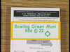
What does St Louis mean?

The Flight Service Station has a remote antenna at the site and ST Lous is the controlling facility
What does shadow boxes mean?
What does the solid black square mean?

Standard FSS frequencies are available in addition to those listed above the box.
FSS Standard Frequencies include 121.5, & 122.2.
The solid black square means Hazardous Inflight Weather Information is available from HIWAS

What does the ‘T’ mean?

The facility has Transcribed Weather Broadcasts (TWEB) - continuous recordings of meteorological and aeronautical information, based on specific routes of flight, and broadcast on certain NDB and VOR frequencies.
What does the underline mean?

The nav-aid has no voice capability
What does the shaded over print mean?

The is some sort of abnormal status and you need to check the NOTAMs
VHF navigation routes are defined by what?

VOR’s designated as Victor Airways

VIctor Airways are normally how many miles wide?
8 NM wide up to 51 NM away from the nav-aid. Then it will diverge outward at an angle of 4.5 degrees.

What does the boxed 41 mean?
What about the unboxed 27 & 14?

Total milage between the radio facilities.
27 & 14 indicate the distance between the reporting points, radio aids, and/or mileage breaks.
In this ex, total distance between Farmington and dede intersection is 27NM, then dedee to Cape is another 14NM. 27 + 14 = 41NM total.

What does the small ‘x’ mean

A Mileage breakdown normally for a course change when a reporting point has not been established.
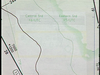
What does the 71/53 mean?

The point where you change frequency between ‘Blue Mesa’ and ‘Pueblo’
What do the arrows at YUMMY intersection mean

The frequency used to define the fix. In this example, YUMMY is defined by the 248 radial from Glade Spring VOR, and the 295 radial from Holeston Mountain Vortac.

What does the open arrow mean?

DME can be used to define the fix. In this example, CALIF intersection is 19NM
What does solid triangles mean?

compulsory reporting point
The pilot of an IFR or controlled VFR flight is required to make position reports over any compulsory reporting points specified on IFR charts, and also over any other reporting point specified by ATC.
The position report shall include the following:
- the identification of the aircraft;
- the identification of the position;
- the time over the reporting point in UTC;
- the altitude or flight level;
- the type of flight plan or flight itinerary filed;
- the name of the next reporting point and the ETA over that point in UTC;
- the name only of the next succeeding reporting point along the route of flight; and
- any additional information requested by ATC or deemed necessary by the pilot.
What does the open triangle mean?

non compulsory reporting point
Not Mandatory
required to make a position report only when requested by ATC.
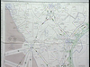
What kind of airspace is this? How can you tell?

Bravo Airspace because it’s blue with a solid line blue border.


