Test Gauge Flashcards

1
Q

You would get a graphic depiction of the landing environment for a particular airfield _____.

A

from the airport sketch on an instrument approach plate for that airfield.–

2
Q

If the departure end of the runway is in sight and you are executing climbout instructions, delay any turns until past the departure end of the runway and _____ feet AGL.

A

d. 400–

3
Q
  1. Use ______ when being vectored to final for a no-gyro PAR.
A

d. standard rate turns—

4
Q
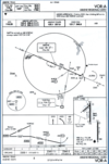
  1. When will you begin your descent to the MDA on the VOR A approach to Abilene Regional?
A

d. At BURGE–

5
Q
  1. As you approach the holding or clearance limit, you should begin slowing to holding airspeed within ______ minute(s) out.
A

b. 3—

6
Q
  1. What type of instrument departure includes specific published routes and altitude restrictions?
A

a. Departure Procedure (DP)

7
Q
  1. You receive these holding instructions from the controller “Hold north of the XYZ 360 degree radial, 20 NM fix, 10 mile legs.” Based on the instructions, you will make _____ turns in the holding pattern.
A

d. right

8
Q
  1. When performing an ITO during cloudy weather conditions, you transition to a completely instrument based cross-check ______.
A

d. will depend on the rate that outside references are lost

9
Q
  1. Which of the following depictions shows a standard holding pattern?
A

d. D

10
Q
  1. You are approaching the IAF for a high altitude teardrop approach at the published IAF altitude. You may begin your descent from this altitude ______.
A

d. when you are past the IAF and established on a parallel or intercept heading to the outbound approach course

11
Q
  1. You can descend from the MDA when _____.
A

b. you can maintain visual contact with the landing environment

12
Q
  1. The heavy black line with an arrowhead showing the intended aircraft ground track on this approach depicts a ______ approach.
A

c. procedure track

13
Q
  1. Instrument Takeoff (ITO) procedures _____.
A

d. are for takeoffs during reduced or restricted visibility conditions–

14
Q
  1. When receiving a new in-flight clearance, you must read back all the following the controller gives you, EXCEPT ______ .
A

a. weather information

15
Q
  1. When transitioning to visual references during an actual instrument final approach, a good technique is to start peeking outside ______.
A

c. nearing the reported weather ceiling

16
Q
  1. If flying an ILS precision approach, the missed approach point occurs _____.
A

b. when you reach the published decision height (DH)

17
Q
  1. The holding pattern (in lieu of a procedure turn) is depicted by _____.
A

c. a holding pattern printed with a bold, black line

18
Q
  1. In the approach active mode, as you approach the FAF on a GPS approach, its ______.
A

d. waypoint identifier flashes on the GPS display

19
Q
  1. When can you descend out of 3500 feet while flying the HI ILS RWY 29R at Fresno Yosemite INTL?
A

d. At SANGO

20
Q
  1. PAR DH is determined by _____.
A

a. aircraft’s barometric altimeter reading b. controller states “At Decision Height” whichever occurs first

21
Q
  1. In the T-6A, you can hold over all of the following EXCEPT _____. a. GPS waypoint b. TACAN c. intersection d. VOR/NDB
A

TACAN

22
Q
  1. Instrument departures are designed to _____.
A

a. safely take the aircraft from takeoff to the next phase of flight (normally an enroute structure to an operating area, the airways, or back to the terminal area)

23
Q
  1. Select the true statement. a. If a barb is not depicted, you have the option of flying the procedure turn. b. If the procedure specifies NoPT, you will not fly a procedure turn. c. If you are established in a holding pattern that is aligned with the procedure turn course, you must fly the procedure turn. d. If you are on radar vectors to final, you may fly the procedure turn.
A

b. If the procedure specifies NoPT, you will not fly a procedure turn.

24
Q
  1. This approach is called a ______.
A

d. Procedure turn

25
Q
  1. On final for a no-gyro ASR, begin using half-standard rate turns _____.
A

a. only when directed by the controller

26
Q
  1. If IMC conditions are likely to be encountered, missed approach instructions for a PAR approach will normally be issued _____.
A

c. on radar downwind or base leg

27
Q
  1. Which of the following can give the illusion of being below the glidepath? a. Flying faster than approach airspeed b. A wider runway than normally experienced c. A narrower runway than normally experienced d. Bright approach lights
A

A wider runway than normally experienced

28
Q
  1. You must set the ILS frequency ______ in the NAV field on the RMU to fly the ILS/DME RWY 13R at Corpus Christi NAS.
A

b. 111.3

29
Q
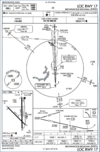
  1. How would you identify the FAF for the LOC RWY 17 approach at Brownwood Regional?
A

d. You can use the OM or the BWD 1.8 DME fix on the localizer

30
Q
  1. You are flying the LOC RWY 17 approach at Brownwood Regional. When can you descend out of 3600 feet?
A

c. When established on the inbound segment

31
Q
  1. MAP on an ASR approach is determined by _____.
A

c. controller instruction

32
Q
  1. Which of the following reduces susceptibility to visual illusions and spatial disorientation while flying an instrument approach? a. Maintaining your instrument cross-check while glancing for visual references b. Making excessive head movements c. Maintaining visual attention to intense stimuli such as bright runway lights d. Flying under conditions of restricted visibility
A

Maintaining your instrument cross-check while glancing for visual references

33
Q
  1. When flying an ILS approach, what action should you take at the glideslope intercept point?
A

d. Reduce power to approximately 22% and lower the nose to “line-on-line” on the EADI

34
Q
  1. While climbing to 5000 feet on a DP, the controller issues you a clearance to “climb and maintain 8000 feet”, an altitude that is higher than the altitude restriction of 7,000 feet at the next fix. What should you do?
A

a. Climb and maintain the assigned altitude while continuing on the DP routing

35
Q
  1. The proper attitude for an instrument takeoff is a wings-level rotation to a pitch attitude of approximately _____ degrees.
A

c. 7-10

36
Q
  1. You have been cleared for the approach. The aircraft heading to the IAF is 135°. Which statement is correct? a. You would turn right after crossing the IAF to a heading of 240°. b. You would turn left after crossing the IAF to a heading of 060°. c. You would turn right after crossing the IAF to maintain the 13 DME arc d. You would turn left after crossing the IAF to maintain the 13 DME arc
A

You would turn right after crossing the IAF to maintain the 13 DME arc

37
Q
  1. Holding airspeed for the T-6A is _____.
A

b. 150 KIAS

38
Q
  1. You are holding over the Newcastle VOR at 14,000 feet MSL. How long will your inbound leg be?
A

a. 1 minute

39
Q
  1. Instrument penetration airspeed in the T-6A is ______ KIAS.
A

d. 200

40
Q
  1. What two steps must you accomplish to configure the GPS for holding?
A

d. Press OBS button and set the holding course

41
Q
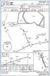
  1. On the GPS display, how would you identify the MAP for the GPS RWY 33 approach to Robert Gray AAF?
A

d. The MAP will be a waypoint suffixed with a lower case “m”.–

42
Q
  1. At rotation speed during an instrument takeoff with an obscured horizon, set takeoff attitude using the _____.
A

c. EADI

43
Q
  1. If no penetration turn altitude is depicted on the approach plate, when will you begin your turn inbound on a non-DME teardrop penetration?
A

d. At an altitude halfway between IAF and FAF altitude

44
Q
  1. When executing a missed approach from a circling maneuver begin a _____.
A

b. climbing turn in the last known direction of the landing runway until established on the missed approach procedure for the runway to which the approach was flown or follow climbout instructions as appropriate

45
Q
  1. Radar controllers provide obstacle clearance using _____.
A

c. Minimum Vectoring Altitudes (MVA)

46
Q
  1. Attempt contact with the controlling agency if no transmissions are received for approximately _____ while being vectored to final.
A

b. 1 minute

47
Q
  1. Along with headings, altitudes, and altimeter settings, during no-gyro radar approach vectors you must also acknowledge ______ until told “do not acknowledge further transmissions” by the controller
A

c. all start/stop turn instructions